Frying today: January Weather report
The weather to which we have been subject this month can be summarised as very hot and very dry. I refer readers to the very clever post by my friend Ian Fraser on the subject of a Sunburnt Country. I will start off with the temperatures.
I thought it would be interesting to look at the pattern of temperatures through the day on the hot days (ie those >35oC. Of the range of temperatures available for each 30 minute period I opted to take the maximum temperature recorded. With 8 days in scope I have plotted the average of the 8 readings and the maximum and minimum for each period.
The pattern for the three series is consistent for much of the day particularly the timng of the turning points. The strange appearance of the minimum line after 1530 is due to the impact of a storm front passing over on 31 January shown below.
The drop between 1500 and 1630 is 12 degrees, of which 8 degrees are regained by 1800 following the skies clearing again.
We recorded precipitation on 4 days. Only once was there more than 0.4mm: this was on the 24th when 6.8mm fell. The total for the month was 7.8mm the lowest in 8 Januarys . A lady at Frances gym who has lived in Burra for 18 years says that this January was the lowest they have ever recorded.
A couple of readings are missing but I don't think they affect matters greatly. Overall the two series total to about the same value: 219.7mm in 2014 vs 214.5mm in 2013. While both years were very dry to begin with, there were 3 days with good rainfall in the last week of 2013, including a huge downpour of 65mm in about an hour on the 26th.
Looking at the direction of the wind through the day, most of the time it was coming from the East. In the charts below I have taken East as the sector from NE to SE (incl).
This shows prevalence of Easterly(ish) winds in the mid-morning and early evening. We particularly notice the latter as it offers a hint of salvation on a hot day.
I have also compiled a chart of percentage of Easterly(ish) winds according to wind speed.
This begins to hint at the reason these fairly dominant East winds are not so noticeable. They are in the ranges described in the Beaufort Scale as "1 Light airs" to middle of "3 Gentle Breeze". In the top of this range leaves and twigs may move - this is not going to be memorable as 'windy'. To get branches moving the speed must be above 20kph where there is a relatively low proportion of Easterly (ish) winds.
Overall a fairly un-humid month, with notably dry readings from 14th to 17th. The spike, >90%, on the 24th was immediately before the rain started,
Temperature
8 maxima were greater than 35oC - not a surprise - while 7 were less than 25oC, which is a great surprise! On the more pleasant side of the ledger 13 nights had a minimum below 10oC. Bringing those observations together, 24 days had a range of >15oC with 7 having a range >25oC.I thought it would be interesting to look at the pattern of temperatures through the day on the hot days (ie those >35oC. Of the range of temperatures available for each 30 minute period I opted to take the maximum temperature recorded. With 8 days in scope I have plotted the average of the 8 readings and the maximum and minimum for each period.
The pattern for the three series is consistent for much of the day particularly the timng of the turning points. The strange appearance of the minimum line after 1530 is due to the impact of a storm front passing over on 31 January shown below.
The drop between 1500 and 1630 is 12 degrees, of which 8 degrees are regained by 1800 following the skies clearing again.
Rainfall
The BoM has been continually muttering about 'chance of showers' 4-5 days out but then they disappear. On their rainfall forecast map here is the situation for 22 January. Plenty of wet stuff on the Canning Stock Route but bugger-all hereWe recorded precipitation on 4 days. Only once was there more than 0.4mm: this was on the 24th when 6.8mm fell. The total for the month was 7.8mm the lowest in 8 Januarys . A lady at Frances gym who has lived in Burra for 18 years says that this January was the lowest they have ever recorded.
Evaporation
One could say that what doesn't come down must still go up. My weather station doesn't record evaporation. Neither does the automatic facility at Canberra Airport and BoM are still trying to recruit a new observer to restart manual readings there. A very helpful person at BoM was able to advise that the nearest site which does record evaporation is Burrinjuck Dam. So here is some evaporation stuff from there.A couple of readings are missing but I don't think they affect matters greatly. Overall the two series total to about the same value: 219.7mm in 2014 vs 214.5mm in 2013. While both years were very dry to begin with, there were 3 days with good rainfall in the last week of 2013, including a huge downpour of 65mm in about an hour on the 26th.
Smoke haze
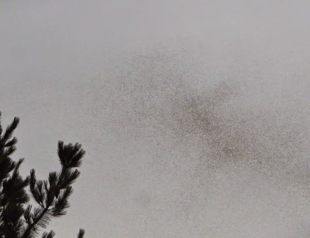
There was astonishing smoke haze in the afternoon of 18 January. Initially said by the RFS to being blown up from Victoria (where the nearest big fires are 270km South) - Victoria is in strife with both the coast route from Melbourne to Sydney and the main road from Adelaide to Melbourne closed by fire. Later in the day it turned out the smoke at Carwoola was coming from a much smaller fire near Araluen (about 50km as the smoke blows)Wind
As always this is a tricky beast to analyse. A first thought is that as recorded by my (low mounted) weather station the maximum gusts per day indicate that the breeze was pretty constant this month.Looking at the direction of the wind through the day, most of the time it was coming from the East. In the charts below I have taken East as the sector from NE to SE (incl).
This shows prevalence of Easterly(ish) winds in the mid-morning and early evening. We particularly notice the latter as it offers a hint of salvation on a hot day.
I have also compiled a chart of percentage of Easterly(ish) winds according to wind speed.
This begins to hint at the reason these fairly dominant East winds are not so noticeable. They are in the ranges described in the Beaufort Scale as "1 Light airs" to middle of "3 Gentle Breeze". In the top of this range leaves and twigs may move - this is not going to be memorable as 'windy'. To get branches moving the speed must be above 20kph where there is a relatively low proportion of Easterly (ish) winds.
Humidity
I apologise to my reader that I forgot this from the initial posting. The usual graph for the 5pm reading:Overall a fairly un-humid month, with notably dry readings from 14th to 17th. The spike, >90%, on the 24th was immediately before the rain started,


Comments