Back to Mexico
So we have left Canberra and are back in Mallacoota. This post covers the trip back and the situation when we arrived.

 Heading towards Imlay Rd our first rainbow was evident.
 Between Bombala and the start of Imlay Rd we saw 8 vehicles. 5 of them were Plodmobiles, so I assumed there was a shift change at the road block. I had expected to stop a couple of times along Imlay Road to photograph flooding Creeks. That was expected as Bombala AWS and a wunderground station at Burragate had recorded over 100mm of rain earlier in the week.
This first image is a sign on the Monaro Highway at Hume.
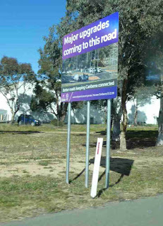 It suggests to me that we might be entering Canberra via Tuggeranong for several months while this work is happening. From my perspective there is nothing wrong with this stretch of road, although the citizens of Jerrabomberra might find it a bit tricky getting to Woden (or visiting their friends and relatives in AMC). The real purpose of the image is using this sign as an example of a style that is popping up all over Canberra with various words. I should put quotes around "words" as in the most egregious example the characters are "signalising" which I don't think is a word.

We played our game of guessing the temperature at Nimmitabel as we left Canberra. It was 12.5C at that point. I went for 11C while Frances chose 8C. By the time we got to Royalla the temperature had dropped to 9.5C , which made me remember a day last year where we both went around 10C but what we found was 2C and snowing.
 Judging by these clouds snow looked to be a possibility. Notice that there are quite a few cars on the Monaro Highway.
 In fact when we got to Nimmitabel it was 5.5C and from memory, drizzly. The traffic had dropped off a lot once we passed Cooma, so perhaps folk were visiting the snowfields. (We had seen snowy peaks as we left Canberra but the Main Range was socked in from the Divide so nothing visible there.


Pretty much as soon as we turned on to the Bombala Rd laying water was decorating the paddocks. The river at Bombala was pretty full but not unduly turbulent. This becomes the Delegate River and then joins the Snowy not too far West of Bombala, so is not connected to the Mallacoota Inlet catchment.


However neither White Rocks Creek nor Imlay looked to have photogenic flows. More water than in recent times but nothing spectacular. On on.
We didn't see a single vehicle on Imlay Rd. It isn't a busy road (apart from the log trucks for which it was built) but to see no vehicles at all in the 57 kms was a surprise. Things weren't much busier on the Princes Highway. It was amusing that the roadblock was prefaced by roadworks signs - presumably there aren't "Roadblock Ahead" signs (yet: I can't image the Plod PR machine is overlooking the chance to give sign writers a bit of action). The operators of the block about 10 of them) looked pretty bored and (despite the gas burner heaters) cold.
 More rainbows were visible once in Victoria.

 Once in Mallacoota Lakeside Drive (or as a witty local has commented now Lake Drive) was closed at the intersection with Angophora Drive. So our street is a good bit busier than usual. This is a house near Broome St, with the water inching up the lawn.
 The Lagoon Boardwalk is a tad damp ...
 .. as is the Fisheries Jetty,


Comments