350 kms of Grey
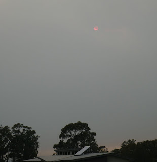
This covers our drive from Mallacoota to Canberra on 6 February 2020. Mallacoota was quite smoky a couple of hours after sunrise.
Here is a zoom to the sun.
This shows our route imposed on a clip from the NSW Fires near me site. The bit in Victoria could also be coloured grey but stupid State borders block NSW from showing that. As close as I can work out the first 140 km of our route were through a fireground.
Welcome to NSW! It was very puzzling how some signs had burnt completely to brown, others in a similar position appeared untouched and yet others were burnt to various degrees.
All the way along Imlay Rd (57 km) the forest had been cut back an extra 10 m on either side. Thoughts about stable doors being closed sprang to mind.
This shows some burnt low vegetation and an example of piled rocks, There are quite a few of these, which I assume is someone having fun with a log grabber.
Or a backhoe, when not cleaning out a culvert!
As we went into Bondi Creek (about 56 km) smoke was evident.
And there is no smoke without fire.
This was a Forestry/Roads horde cleaning up the sides of the Monaro Hwy above the intersection with Imlay Rd.
This sign annoys the squarrox out of me. Check Live Traffic - and get a ticket for using your phone while driving.
I think the next two are approaching Bredbo and show the Southern end of the Orroral fire.
The climbing lane North of Bredbo where the Clear Range fire came across the Monaro Highway.
Here is a zoom to the sun.
This shows our route imposed on a clip from the NSW Fires near me site. The bit in Victoria could also be coloured grey but stupid State borders block NSW from showing that. As close as I can work out the first 140 km of our route were through a fireground.
Welcome to NSW! It was very puzzling how some signs had burnt completely to brown, others in a similar position appeared untouched and yet others were burnt to various degrees.
All the way along Imlay Rd (57 km) the forest had been cut back an extra 10 m on either side. Thoughts about stable doors being closed sprang to mind.
This shows some burnt low vegetation and an example of piled rocks, There are quite a few of these, which I assume is someone having fun with a log grabber.
Or a backhoe, when not cleaning out a culvert!
As we went into Bondi Creek (about 56 km) smoke was evident.
And there is no smoke without fire.
This was a Forestry/Roads horde cleaning up the sides of the Monaro Hwy above the intersection with Imlay Rd.
I think this was taken somewhere around Bibbenluke showing both the smoke haze and the dry country.
Somewhere between Nimmitabel and Cooma.This sign annoys the squarrox out of me. Check Live Traffic - and get a ticket for using your phone while driving.
I think the next two are approaching Bredbo and show the Southern end of the Orroral fire.
The climbing lane North of Bredbo where the Clear Range fire came across the Monaro Highway.
This shows the Orroral fire from Royalla. It may be a backburn.
I'd hoped to include an image of the pink roundabout at ANZAC Pde where a plane accidentally dumped 2000 litres of retardant but it had been cleaned up. (Actually, given the ACT Government's propensity to put colours on roundabouts as an indicator of inclusiveness, I wonder if it wasn't an intentional effort. Having it on the vista to the War Memorial would stir up the RSL!)


Comments