Posts

Showing posts with the label geology

The drive back

Image
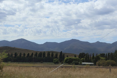
 This is basically a set of photos I took, being passenger, as we came back to Mallacoota.   I began as we passed Michelago  with the Tinderry Range in the background. This closer view just about shows the amount of bare rock still visible. I suspect the area is still recovering from the fire which went through the area in 200 9.  (We could see the fire from Carwoola, 25km North, at a community Christmas party!) Communications towers are now a common sight along the way. I think this straight, at Billilingra, is about 6km long.  It has unusually light traffic.  The length is the same as the Mulsanne Straight used to be in the Le Mans race: the top speed recorded there (before chicanes were inserted) was 405 kph - that would mess with the average speed cameras! Irrigation at Dromore. When we had a weekender at Kalaru (near Tathra) we used to pass through Cooma about every 3 weeks on our way.  We felt very clever avoiding central Cooma by cutting a...
Walking the Molonglo Gorge(s)

Image
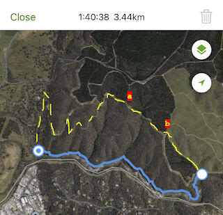
 To check out a geological site we walked from the Molonglo Gorge car park to Blue Tiles and back.  To avoid the scrambly bits of the track closest to the River (blue line) we came back on forest tracks (yellow dashes). A view down on to the Molonglo River.  A surprisingly strong flow considering the dry conditions. Much moss on this rockface indicates a moist microclimate.  We were surprised that we didn't spot any ferns. More gorge views. This wattle has been identified on iNaturalist as Acacia rubida , which I should have been able to identify myself. Our turn point at Blue Tiles picnic area. I didn't enjoy the rough walk along the track so decided after looking at the map to walk the roads along the edge of Kowen Forest instead. It looked a little longer but much easier walking.  Unfortunately it didn't include the contours of which there were several!  This was the nastiest, between points A and B on the map  From fiddling with Google Earth the cr...

A different way to Canberra

Image
 Frances has a developing interest in geology and "Stories beneath our feet " had a number of references to features between Bombala and Berridale.  We had never driven the Snowy River Way so it seemed like a few ducks lined up.  As well as this innovation we decided to come via Cann River as the fuel price there was the cheapest (diesel 181.9 c/l, cf 215.9 in Mallacoota or 186.9 in Bombala) between home and Canberra.  Here is our route: about 20km and 40 minutes longer than our normal route We had taken the Pajero as:  I wanted to get a new rear light assembly as the sticky tape I had been using on it for the last 8 years was getting a bit iffy;  I wasn't sure what the road from Ando to Berridale would be like; and We might want to go into the mountains while we are in Canberra. I have added a 4th element having done the trip: the Monaro Highway from Cann River to Bombala is in very poor condition.  We were pleased we weren't taking the Mazda which is...

Reid and Acton: many parrots.

Image
 This is about two walks we did on 29 April.  The catalyst for some elements of both walks was Frances' reading material about geology, particularly material about interesting geological sites around Canberra.  For the first walk, a variant on one of our usual walks around the suburb of Reid, the geology was in the rock used to build St Johns Church, but the material below follows our path to the church.  Here is the route. There is a lot of foliage colour in the area when looking down from our apartment.  This is an example early in our walk. An historic sight!  No idea if anyone still uses it, but given the way Australia Post is reducing services in the area its possible it hasn't been emptied for quite a while. We were struck by the colours in this damp wood.  Perhaps pile it around the fireplace but don't actually burn it. Not all the leaves have changed.  These oaks in Booroondara St are still quite lushly green. Truth in advertising.  I...