Posts

Showing posts with the label Weather Mallacoota

Rivers of the drive back
Image
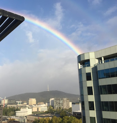
 Our plan was to drive back on 24 March.  We decided to stick to that despite knowing that: Mallacoota had scored (according to the BoM) 107mm of rain; The power was out (but due back at 1100  hrs); and Lakeside Drive was closed due to fallen trees. In Canberra the sun had come out, mixing with a final shower from the Brindabellas. I thought it would be interesting to take photos of the rivers we passed/crossed on the trip, to record how high they were.  We didn't bother with the Molonglo as it was just brown and within its banks at Dairy Road.  The first major stream was the Bredbo River.  The safety barriers were a view-obstructing pain in the Jetta but the way the poplars are poking out of the water shows that it was well above normal. The Numeralla River was similar.  I can remember seeing this much wider - on this trip the secondary channel was still dry. As we turned on to the Snowy Mountains Highway at Cooma a couple of buses passed in front of ...
Back to Mexico

Image
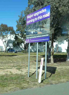
So we have left Canberra and are back in Mallacoota.  This post covers the trip back and the situation when we arrived. This first image is a sign on the Monaro Highway at Hume. It suggests to me that we might be entering Canberra via Tuggeranong for several months while this work is happening.  From my perspective there is nothing wrong with this stretch of road, although the citizens of Jerrabomberra might find it a bit tricky getting to Woden (or visiting their friends and relatives in AMC).  The real purpose of the image is using this sign as an example of a style that is popping up all over Canberra with various words.  I should put quotes around "words" as in the most egregious example the characters are "signalising" which I don't think is a word. We played our game of guessing the temperature at Nimmitabel as we left Canberra.  It was 12.5C at that point.  I went for 11C  while Frances chose 8C.  By the time we got to Royalla the temperatu...

Openings and closings

Image
The day opened with the closing of the moon; I thought there could be quite a good sunrise this morning, but if there was it was not evident on the occasions I checked it.  However when the fog closed in it was quite attractive.  Later in the day I went for a ride from home to Bucklands to the wharf and home again.  My main aim was to get some photos of the various areas that are damp, despite the opening of the Inlet.  I started taking photos at the entrance to the Park at Bucklands.  The sign is correct!  There wasn't a sign announcing closure of the bike path - and the one in the background prohibiting camping is probably a tad redundant. There had been some comments on a Facebook group about the difficulty of launching boats at the current water levels.  Quite a few folk had obviously worked out how to do this at Karbeethong, in some cases without a 4x4!  It would probably help to have prior knowledge of exactly where the ram...

Typical days

Image
We have now been living in our house for about 10 days and are almost starting to begin to think about a routine.  Before getting to that here are a couple of samples of the kultcha of far south NSW.  First from Pambula ... .. and then the Princes Highway about 20km South of Eden. Well done Natalia! Clouds and sun getting their act together on the 15th.  This view from the front door ... .. and this hanging off the East end of the back deck. I have decided to start a collection of cloud photos.  This is a cirrus formation showing two different levels moving at right angles to each other! I went for a bike ride using Frances device (as mine is in bike hospital in Merimbula at present).  The bike has a bit of a Mary Poppins look to it but goes well. and gets me where I wish to go. This was assessing a lap up to Mirrabooka Rd and back to the Lakeside.  At 4.6km it could be quite  nice jogging track sometime. This is the top of our ...