The drive back
This is basically a set of photos I took, being passenger, as we came back to Mallacoota.
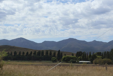
I began as we passed Michelago with the Tinderry Range in the background.
This closer view just about shows the amount of bare rock still visible. I suspect the area is still recovering from the fire which went through the area in 2009. (We could see the fire from Carwoola, 25km North, at a community Christmas party!)Communications towers are now a common sight along the way.
I think this straight, at Billilingra, is about 6km long. It has unusually light traffic. The length is the same as the Mulsanne Straight used to be in the Le Mans race: the top speed recorded there (before chicanes were inserted) was 405 kph - that would mess with the average speed cameras!
Irrigation at Dromore.
When we had a weekender at Kalaru (near Tathra) we used to pass through Cooma about every 3 weeks on our way. We felt very clever avoiding central Cooma by cutting along Polo Flat Rd. The servo there also used to give very good fuel prices! The short cut is now preferred by Google Maps and the servo is one of the more expensive on the trip 😭
When we passed through on a Sunday, heading back from Kalaru we often saw a group of blokes working at this small shed! We initially thought they were druids, but it was actually the Cooma Pistol club building a range. We haven't seen anyone there for years!
The next couple of images show the geology of the area between Comma and Nimmitabel. There are few trees to get in the way of the geology! Most of the area has a volcanic origin, so I guess this is a sill ...
... and this shows a few small plugs poking out of the tableland. Knowing the nature of this geology has made the area much more interesting. (A friend who has some country East of Nimmitabel was happy for me to collect some granite (or basalt, they had both). When I said how much could I take his response was "After a million tons we'd probably have to start charging.")
This grey car was a nuisance as he didn't keep a steady speed. The two bikies were not a nuisance as, once they got clear of the roadworks - after a 5 minute wait grrrrrr - they hit Warp Factor 7!
The next two images - possibly at this stop near the start of the road to Bombala - summarise a bit of the trip. I had first go at guessing the temperature at Nimmitabal (as we left Canberra) and went for 25C which just beat Frances's guess of 24: at one point it looked as though we might both lose since 28 seemed possible.
Metal cow sculptures at Bombala.
Only in Australia ....
The drop into the Genoa River Valley is the edge of the Monaro Tablelands, and if we were going that way, where we'd turn on to Imlay Rd.
This used to be forest but it got burnt in the Black Summer fire - about 140 road-kilometres from Mallacoota - and then clear felled to use the wood.
These pipes drain the bank to stop it eroding.
The border. The yacht kept going pretty well but eventually pulled over near West Cann Rd.
We stopped for fuel at Cann River with the readout showing we still had 250 left. Frances driving at 101kph on cruise control was very economical achieving an average of 8.1 litres/100km - pretty good for a full size 4X4. As we left the apartment our range was 330km which had enough of a margin (30km) to take advantage of the good price at Cann River. Shows the difference between city and country driving.


Comments